Global Warming and Agriculture
Climate change is a growing concern for many industries. It’s a well known fact that with climate change, we will see warmer temperatures, sea level rise, and changes in precipitation patterns, but what we don’t know is how it will adversely affect critical industries and infrastructure. AgriGenics aims to plan for the unknown by helping you visualize how climate patterns may change over time and how it will affect your industry.
MAPPING THE UNKNOWN
Using GIS, AgriGenics can help you visualize how climate patterns will change over your specific area and we can make recommendations accordingly.
A few of our examples are below. Even if you don’t see an example of what you need here, get in touch with us to see if we can help you with your specific needs.
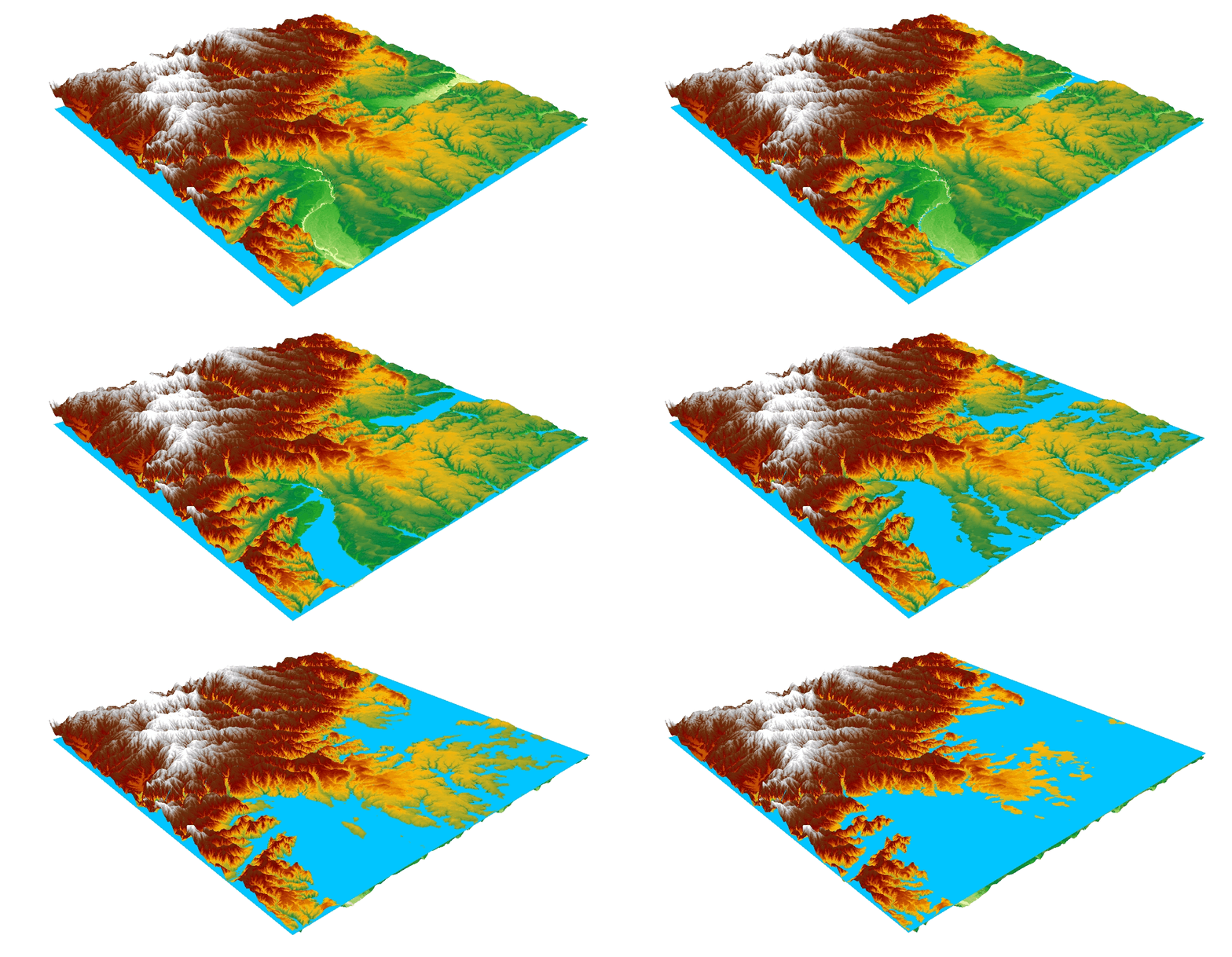
Flood Map Simulation
This animated image shows flooding risk over a specified area. It is important to understand flooding patterns especially if your area is near a stream or in low-lying elevations. Flooding can devastate crop production and health, so being prepared for the worst-case scenario can help minimize the impact of climate change.
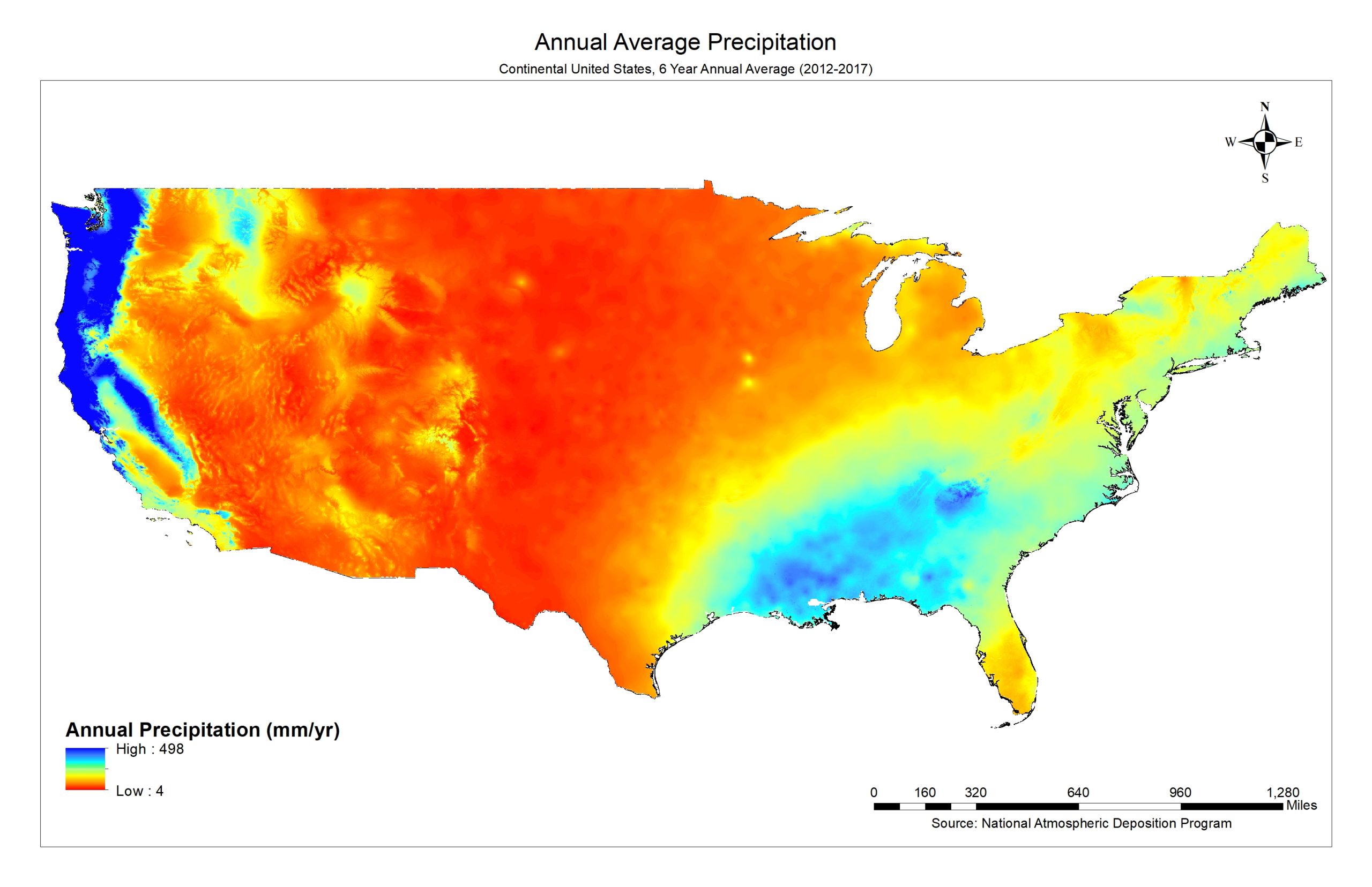
Precipitation Patterns
As global warming continues, we can expect the drying of already arid environments and an increase in storm frequency and intensity in areas affected by storms. Understanding precipitation patterns can help you mitigate the adverse affects of climate change to maximize crop production.